While virtually unheard of until 2010s, now digital twins appear to be omnipresent. BMW is running production lines in virtual space and Thames Water is tracking leaks in its digital water network. There are digital twins of cars, aircraft engines, and wind turbines. Moving physical things into digital space lets imagination and creativity run free – you can test and experiment as much as you want, while your real-life assets are intact, safe, and working as usual.
Almost every industry is venturing into digital space, with aerospace and defense leading the global adoption of the digital twin technology. Modeling, prototyping, and simulation are the most common use cases in these sectors, with companies taking advantage of the digital space to test their design ideas and scenarios.
Global market for geospatial digital twins by end-user

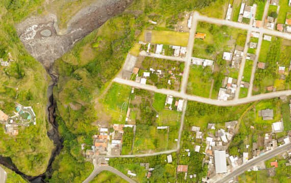
When digital twins are referenced to a geographic location, they become geospatial digital twins. Imagine recreating entire buildings, cities, or areas in the digital space, exactly matching the real-world environment, in real time? This is what geospatial digital twins are about.
The market feels the same excitement, with the digital twin sector of the geospatial industry forecast to reach roughly US$ 25 billion by 2026, according to World Geospatial Industry Council. Fusing the latest innovations in the Internet of Things, artificial intelligence, geographic information system (GIS) technology, and cloud technologies, geospatial digital twins promise significant improvement in data-based decision-making for multiple industries.
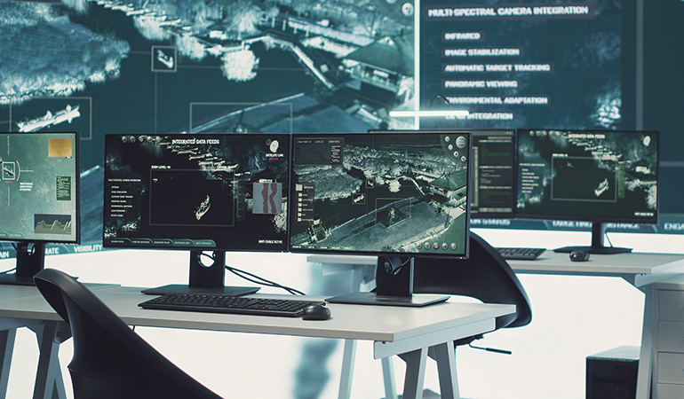
Understanding digital twins
As the name suggests, digital twins are virtual copies of real-world objects that exist and function in parallel with their physical counterparts. The digital twin technology enables real-time updates of a virtual replica to make it behave like the real object it represents.
Creation of a digital twin involves a fusion of several cutting-edge technologies:
- Internet of Things that provides the necessary sensor or camera data to create and update the virtual replica.
- Cloud computing that hosts the digital twin infrastructure and enables necessary integrations
- Geographic information systems (GIS) that supply location data for geospatial digital twins and enable digital twin mapping
- Artificial intelligence and machine learning that process sensor data and identify trends and patterns for simulation, modeling, and predictive analytics
- Visualization that enables the creation and presentation of 3D replicas of physical objects
When these technologies are used in a digital twin solution, you get a 3D model of the original object, together with its geographic mapping, component interactions, and processes running exactly as they do in real life. A continuous stream of data from IoT devices ensures that a digital twin is updated to match the events and changes affecting its real-world counterpart. The beauty of adding geospatial data is that it turns a 3D model into a multi-dimensional model of the digital twin, with all the added live and historical information for numerous slices/dimensions representing different sensors (photographic, LiDAR, infrared, X-ray, temperature, accelerometer, touch, flow, ultrasound, etc.).
By running change scenarios in the digital twin, you can observe the direct and indirect influence of your changes on all components of the modeled object. Sometimes, a digital simulation reveals unexpected ripple effects that were hard to predict and require rethinking of the entire plan. Such modeling and simulation capabilities make digital twins so popular across industries.
A dynamic digital simulation is at the core of NASA’s “Wildfire Digital Twin” initiative aimed at “taming” wildfires. Powered by AI and predictive analytics, the model can estimate wildfire spreading, giving firefighters time to respond and minimize the damages. This is but one example of how digital twins can improve our lives. And just think that the technology is in its early childhood!
Integration of the digital twin technology and GIS
GIS and related geospatial technology are essential to creating geospatial digital twins, providing the location data needed to map a digital replica to the corresponding physical space. Additionally, GIS delivers real-time data that allows for simulating changing conditions in the physical world. Here’s how GIS contributes to the creation of geospatial digital twins:
- Spatial data integration. GIS unifies different types of spatial data – topography, infrastructure, environmental, land use, and more – into a single platform hosting a detailed digital twin.
- Data visualization. Data obtained from various sources is used to build an interactive map representing a cohesive view of all objects and processes in physical space.
- Real-time data monitoring. GIS systems consume real-time data provided by IoT devices and update corresponding assets in the digital twin, ensuring synchronization of real and virtual conditions.
- Spatial analysis. Location data obtained from GIS becomes the basis for identifying patterns and relationships between spatial objects, as well as for generating insights about their conditions.
- Modeling and simulation. Based on GIS data, digital twins can model the effects of both natural and technological changes, running various scenarios and predicting their outcomes.
Using GIS in the creation of digital twins enhances decision-making opportunities by placing objects, events, and their relationships in spatial context, highlighting trends and patterns as they exist in the real world. Spatial intelligence provided by GIS allows for building digital twins that almost perfectly reflect the real world, enabling accurate predictive analytics and data-driven decision-making.

Use cases of geospatial digital twins
Digital twins are mostly used as environments for simulating various events and conditions and understanding exactly how such scenarios will affect the entire ecosystem.
For example, what would happen if the city shut down one of the bridges? A GIS technology-based digital twin replicating all the infrastructure, terrain, and traffic – minus the bridge – could show where traffic jams are likely to occur. With this knowledge, city officials can better plan the road works or even reject a certain project, if its consequences turn out to have a negative effect on the traffic.
Or consider a telecom provider planning CAPEX investment into a certain region based on real estate development plans. It can use a digital twin to estimate how many base stations (BTS) and base stations controllers (BSC) are needed, considering the projected growth in the region. If certain residential development projects take longer, or occupancy rates are lower than expected, can the operator roll out a gradual CAPEX investment plan instead of building the infrastructure that won’t be utilized? A digital twin of the region could help the telecom provider model different scenarios and plan an optimal investment strategy.
Let’s look at other typical use cases of geospatial digital twins.
Urban planning and development
Urban planning is a prime use case for geospatial digital twins. With whole cities or areas recreated in the virtual space, developers can evaluate multiple design and planning options before starting work in the real world.
Urban digital twins typically replicate traffic and infrastructure, utilities, and energy networks, allowing city planners to monitor the status of the urban environment and run various change scenarios to observe possible effects. IoT devices strategically placed across the city provide real-time status data for analytics and future predictions.
With AI and advanced analytics processing incoming urban data, digital twins open multiple opportunities for urban planning that include:
- Scenario testing. City planners can simulate both natural disasters and events caused by humans in virtual space to see their potential effect on the city and mitigate possible risks. For example, a city can assess the effect of a population increase on traffic and infrastructure, the environmental impact of adding new residential districts, or potential traffic congestion caused by planned roadworks.
- Infrastructure optimization. Real-time data provides insights into traffic patterns, energy consumption, and utility operations. By monitoring and analyzing data obtained from IoT devices, city planners can optimize operations, such as adjusting traffic light cycles to enable smoother traffic or changing street lighting patterns to reduce energy consumption.
- Promoting sustainability. By modeling the environmental effect of various development plans, traffic routes, building materials, and infrastructure layouts, the city can choose the most environmentally friendly options before beginning a project. Digital twins can also produce real-time temperature and air quality maps and show the effect of planned construction on the ambient temperature and air. This information is useful for planning parks, water bodies and other green infrastructure components that can improve the developed area conditions.
- Community engagement. Using visualization tools within the digital twin technology, city planners can communicate their design ideas to residents, enhancing transparency and public engagement. Such initiatives encourage feedback from the community, ensuring that urban development aligns with the residents’ expectations.
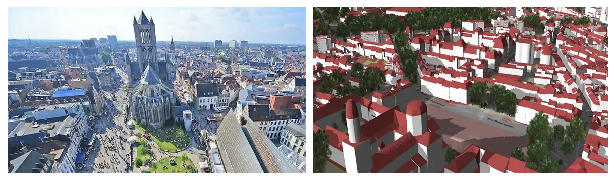
One such example of the digital twin concept in a city is the DUET (Digital Urban European Twin) initiative that unites multiple technology partners with a common goal of more democratic, efficient, and sustainable urban development. One of the DUET projects, Flanders Twin, is based on the geospatial digital twin approach. It recreates an area in Belgium and is focused on using digital technologies to achieve smoother mobility and build a more environmentally friendly community.
Telecommunications
The telecom industry uses geospatial digital twins to manage and optimize networks and improve services. Using GIS mapping software, telecom providers obtain exact digital copies of their distributed networks with real-time updates and achieve multiple goals:
- Network planning and optimization. With detailed geospatial data, telecom companies can reference their assets (base transceiver stations, base station controllers, lines and infrastructure) to terrain and buildings and use this information to find optimal locations for new infrastructure to ensure reliable coverage.
- Predictive maintenance. IoT data coming from devices located across telecommunication networks allows for detecting failures and service degradation early to ensure timely repairs. With such a proactive approach, telecom companies can reduce downtime and maintain consistent service.
- Site management. By monitoring infrastructure sites through digital twins, telecom companies can practice remote management and audits, reducing the need for physical visits to locations. This way, companies can reduce costs and increase work safety.
- Disaster recovery. Geospatial data providing real-time updates on weather conditions offers insights into the probability of natural disasters. Based on such insights, telecom providers can build effective disaster recovery strategies and minimize service disruptions.
A good example of how geospatial digital twins are used in telecommunications is Ericsson Site Digital Twin. It offers an interactive interface for designing new telecom sites with fewer site visits. The solution provides telecom companies with greater engineering accuracy, work safety, and sustainability.
Environmental monitoring
Mapping environmental conditions to exact digital representations of geographic locations is a new step in the global trend towards eco-friendliness and sustainability. Geospatial digital twins of real-world environmental conditions shed light onto factors affecting climate change and ways to slow it down:
- Real-time monitoring. Digital twins enable tracking of various types of environment-related data: air and water quality, soil conditions, water levels, temperatures, and more. With continuous monitoring of dynamically updated data, scientists can get a comprehensive picture of environmental conditions at a location and use it to plan improvement measures, such as planting forests or switching to green energy production.
- Data integration. Digital twins consume data from various sources, including sensors, cameras, satellites, and combine it into a cohesive view of a geographic area that offers a dynamic representation of the entire ecosystem. Integrated data provides insights into understanding the relationships among different environmental factors and identifies trends and patterns affecting the biological systems in the region.
- Scenario testing. Environmental scientists can use digital twins to run various what-if scenarios, simulating changing conditions and observing their effects in virtual space. For example, a digital twin can show how rising temperatures affect the flora of a certain area or what consequences land development will have on an ecosystem.
- Natural disaster response planning. Digital twin scenarios may include recreating natural disasters typical for a location to show possible consequences and suggest optimal response strategies. In addition, monitoring of real-time weather data can help to accurately predict natural disasters early enough to put disaster preparedness plans into action.
One of the most ambitious environment-centered digital twin initiatives is Destination Earth, a project of the European Commission with the goal of building an accurate digital twin of our planet to monitor natural phenomena, human activities and their effects on the environment. Destination Earth is part of a complex strategy aimed at addressing climate change.
Benefits of geospatial digital twins
Building a geospatial digital twin promises multiple benefits for enterprises in various industries. Real-time data mapped to GIS-enabled spatial intelligence opens unique opportunities for testing, monitoring, and predictive analytics.
Data-driven decision-making
Based on real-time spatial data represented in rich visualization formats, companies can make informed decisions in urban planning, infrastructure development and management, and environmental protection. With accurate location-referenced data provided by GIS software, businesses can validate their ideas in digital space and launch their real-world projects with confidence.
Higher efficiency and cost optimization
Working with dynamic digital copies of real-world assets, companies can optimize their resources and costs by practicing proactive maintenance. Digital twins help to detect issues early, and spatial data permits pinpointing of exact locations that require attention.
Improved sustainability
Eco-focused digital twins provide lots of insights into the effect of human activities on the environment. Through different digital scenarios, scientists can find ways to reduce our environmental footprint, while businesses can incorporate more eco-friendly practices.
Business collaboration
By representing data in intuitive visual formats, digital twins expand the audience beyond data scientists to other non-technical professionals. This way, stakeholders across the company can participate in decision-making using data that has been processed and converted into easily consumable formats.
Better risk management
Data obtained from IoT devices enables early detection of natural disasters and technological failures. Armed with information about a potential disaster and its exact location provided by spatial intelligence, companies can take appropriate measures to mitigate the risks. At the same time, GIS-based digital twins can be used in planning post-disaster activities and service restoration by providing real-time data on affected locations.
Challenges and considerations
While there are multiple benefits of digital twins, there may be some challenges in their implementation. Difficulties are mostly related to the sophisticated technologies involved in the creation, deployment, and use of digital twins. Let’s look at typical issues companies run into when planning and using digital twins.
Data quality
The output of a digital twin output is only as good as the data it consumes. Geospatial digital twins that receive data from multiple sources in different formats – sensors, cameras, LiDAR scanners,
etc. – depend on the quality of data in order to generate meaningful business insights.
This challenge can be overcome by implementing advanced data integration tools that enable the ingestion and processing of different types of data and combine them into cohesive outputs.
Integration with other systems
To achieve the maximum benefits, a geospatial digital twin needs to be integrated into the business ecosystem, enabling effective data exchange with the rest of its components. Establishing connectivity between the digital twin and legacy software may be a daunting task, and the quality of the integration may significantly affect business outcomes.
Expertise gap
Based on cutting-edge technologies, digital twins have a steep learning curve. Often, working with digital twins requires specialized expertise and experience, which may be hard to find.
For this reason, it is important to design digital twins using rich visualization techniques to allow people with different professional skills to access and use insights generated by digital twin technology.
Scalability
With an increase in the area covered by a digital twin or the volume of data to be processed, it may be challenging to scale the digital twin technology while ensuring the same quality of data collection and processing.
Scaling a digital twin up or out typically involves significant additional resources and may affect operational consistency and component integration.
Data security
The multiple data sources and various communication technologies involved in the operation of a geospatial digital twin present a risk of a data breach. Real-time data communication channels are often a prime target for cybercriminals.
Companies using digital twins need to invest in strong security mechanisms involving data encryption and user authentication to protect their digital assets.
High cost of entry
A geospatial digital twin is a complex system of both hardware and software using the latest technology solutions. Even a basic system entails high initial investments, which may be cost-prohibitive for small and midsize businesses.
Moreover, implementation and maintenance of a digital twin requires specialized expertise that needs to be procured either in-house or via a costlier outsourcing model.
Intellias digital twin experience
As a technology company that recognizes the power of pioneering technologies to transform businesses, Intellias has prioritized the research and development of digital twin solutions. Our company assists businesses with the implementation of digital twin technology in multiple industries through offering our Intellias Digital Twin proprietary digital twin accelerator.
Intellias Digital Twin was developed in collaboration with Intel. It allows companies to build digital copies of physical assets with rich 3D visualizations and use advanced mapping software to generate geospatial datasets. Intellias Digital Twin also supports real-time updates and geospatial mapping, referencing digital objects to geographic locations. Businesses can use Intellias Digital Twin to monitor their real-life processes in a digital space or run various test scenarios to validate ideas.
Intellias Digital Twin was acknowledged by Information Services Group (ISG) as a business-oriented technology solution that can streamline enterprise processes in multiple industries. Focused on accelerating development, Intellias Digital Twin represents a platform for quick and cost-effective deployment of digital twins of varying complexity.
Future trends and innovations
The digital twin market is growing rapidly, with both technology providers and investors paying more attention to this field of research. According to Digital Twin Insider, revenue may reach US$ 110 billion by 2028. Global industry leaders such as Siemens, NVIDIA, and IBM view digital twins as one of their primary R&D areas, launching proprietary solutions for various use cases.
Digital twins are also becoming more sophisticated, leveraging the latest technological innovations such as AI/ML, big data, mixed reality, and GIS. As a result, digital twins are turning into truly immersive products that accurately replicate real-life objects and can simulate multiple processes with a high degree of precision.
The range of industries adopting digital twin technologies is also expanding. While construction, urban development, automotive, and manufacturing have been experimenting with digital twins for several years, this technology is now finding uses in such areas as space and environmental studies.
As more companies recognize the benefits of digital twins as a virtual space for planning, testing, experimenting, and validating ideas, the future of digital twins looks bright. They expand their capabilities and become easier to adopt. These combined trends suggest that we may see many interesting digital twin projects in various industries, helping businesses design and plan their growth.
Win with digital twins
At first glance, implementing a geospatial digital twin may seem a challenging task. A digital twin is typically a technology-loaded project that requires special knowledge and expertise. Partnering with a professional IT and GIS services company will be your first step to success in the digital twin space.
Recreating your physical assets in a virtual environment gives you opportunities as limitless as the digital space itself. Explore, experiment, and test your boldest ideas without disrupting your business operations for even a second. We will help you make the most of your digital data by harnessing the latest technologies and linking your virtual and physical environments, so that your creativity and innovation can flourish.