You might not even realize how often you interact with geographic information systems (GIS) in your everyday lives. Searching where to buy a cup of good coffee, uploading your selfie with an exact location, using precise weather forecasts to plan your vacation, avoiding traffic jams by looking at a virtual map – this all is possible thanks to GIS applications.
The ways businesses use these GIS technologies are even more impressive. Construction and real estate, logistics and fleet management, telematics, agriculture, defense and public health are only some of the industries that rely on GIS spatial analysis. What are the components of GIS, and how can businesses leverage the spatial modeling to optimize their processes? GIS development services have explanation for all of these.

What is GIS application?
A geographic information system is a tool for capturing, analyzing, manipulating and visualizing spatial and mapping data. The thing is to combine geographic information (location on earth) with attribute data (info about the location features) and present it on a map from various angles, depending on the tasks. Every GIS application goes through four basic stages:
- Creating or capturing spatial data
- Managing it
- Analyzing
- Visualizing it on the map
What are the primary reasons for using GIS?
- mapping locations, their features and relationships
- mapping quantities and densities
- defining areas of interest and mapping the insides
- mapping changes
With time, GIS has gone far beyond its primary capabilities: today’s geosystems leverage cloud computing, big data, drones and wearables. Thanks to GIS and spatial mapping, the ways to gather, analyze and display information have evolved dramatically as well as the possibilities and means of using it.
Must-have components of GIS applications
Platforms that provide GIS tools have a set of features that allow businesses from different industries to build their entire processes around spatial modeling. Here are the critical features of GIS technologies that influence decision making and risk management in more than a dozen fields.
Remote sensing
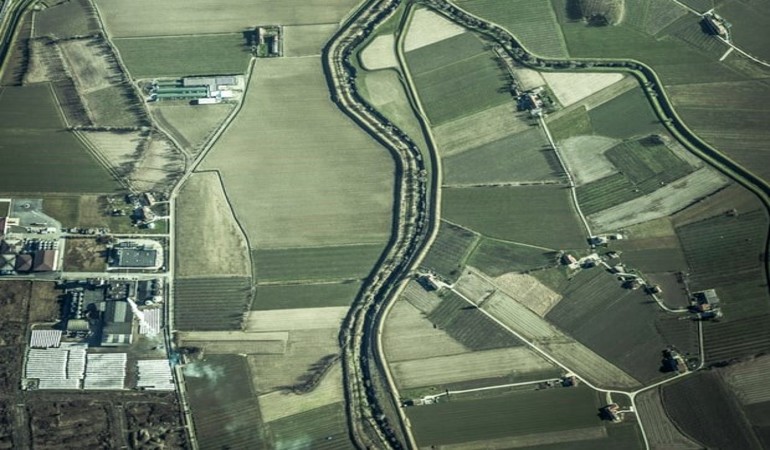
Engineering constructions, as well as drones, aircraft and satellites, can carry various sensors that help to map locations. They collect data from the objects on the surface by detecting the reflected energy. Remote sensing is quite accurate since it uses active microwave sensors such as radar, lidar, scatterometer, sounder, etc.
In GIS, remote sensing is used to determine topography and generate a 3D view of
- the earth surface
- the progress of land use over the years (say, the pace of city development)
- impervious surfaces (such as overbuilt city blocks), etc.
This helps to evaluate locations for construction, environmental threats, the progress of development and many more. In agriculture, satellite remote sensing and GIS can assist in proper water use by determining the best locations for crop production. Another case is risk management: insurance companies use drones to evaluate crop damage and areas that need immediate attention.
Real-time GIS
Immediate geographic insights reduce operation costs by ensuring instant decision making and risk management. You can quickly react to changing conditions and share real-time data from multiple sensors and other IoT devices. Today’s GIS software allows you to adjust filters and location-based analytics, which will automatically refine and focus real-time data on the events that matter most to you.
Processing and analyzing geographical data in real time is vital for fleet management, telematics, defense and intelligence operations, public works, public health, forestry, mining, water and gas management, public safety and emergency management, transportation and utilities.
GIS spatial analysis
When we look at a map, we start analyzing what we see, looking for patterns, assessing trends, searching for information to make decisions. This is a kind of spatial analysis we do on our own. But, of course, GIS is more powerful and way faster. By leveraging big data and IoT devices, the system lets you determine relationships, detect and count patterns and even make predictions. Spatial analytics brings indispensable context to everything from customer buying habits to supply chain management, market planning, competitive tracking, and operational optimization.
The use cases are numerous: crime studies, weather conditions analysis, infrastructure planning, customer behavior insights and many more. Combined with AI, which is an unmatched tool for pattern detection and analysis, GIS may become a serious competitive advantage of any business.
3D GIS
3D GIS goes beyond the coordinates and depicts objects in more details by adding a third dimension. This way, you not only have the location of a building but its height as well. 3D is used to represent
- urban areas and their population density
- land suitable for construction
- concentration of minerals
- position of aircraft
3D visualization helps to create more detailed and insightful maps for city planning, coastal modeling, wind farms planning, etc. Roadmaps from the GIS database can be extrapolated to create geometrically correct and topologically consistent 3D models automatically. They can then be used for real-time traffic simulation, interactive visualization of the virtual world or autonomous vehicle navigation.
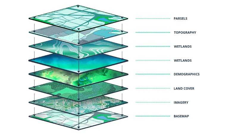
Mapping and visualization
Modern GIS systems create maps in a series of layers, each displaying a specific dataset, accompanied with attribute information. In its turn, GIS mapping helps in geo-visualization known as the creation and manipulation of images, charts, maps, diagrams, 3D views and their associated tabular datasets.
Source: New Brighton
The takeaways
GIS is a rapidly changing technology that merges flawlessly with many other technologies you may be interested in, such as video, web development, and phone apps. GIS will increasingly become part of the norm of our daily lives, and the digital experiences it affords will become expected. GIS and different application are instrumental in reshaping our experience of place.
Modern GIS systems – what do they look like?
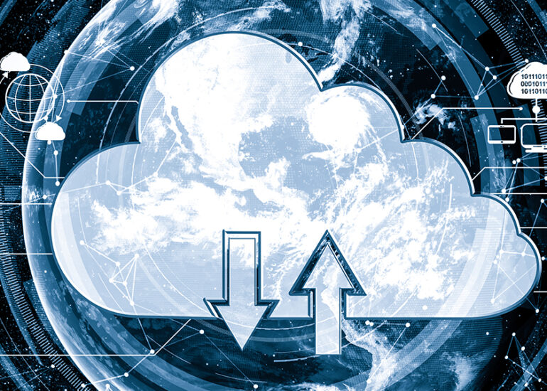
Today’s GIS platforms are web-based, exploiting the capacity of the cloud and allowing access from anywhere at any time. They naturally use various IoT devices, from sensors to drones. Also, the GIS industry has its own name for interaction with big data: it’s called Spatial Big Data (SBD). As for artificial intelligence, geo-AI is still a new field: machine learning and deep learning can be really convenient in work optimization and cost-efficiency, but data structure and diversity is a challenge here.
The combination of GIS and 3D printing creates physical models for real estate, military use, geological purposes and education. All in all, the GIS industry leverages tech innovations no less than any other field, and they add up to the platforms’ productivity, use cases and efficiency. It means that the penetration of geo-systems into businesses and processes is sure to continue since it has proven to be beneficial and highly demanded.
Contact Intellias to get advice on applying GIS technologies to your business needs with expert consultancy from GIS engineers.