Project highlights
- Capture spatial data from various sources using GIS tools
- Convert data from different formats into a proprietary format
- Compile maps for transportation and logistics eight times faster
- Industry:
- Transportation & Logistics
- Country:
- Germany
- Cooperation:
- May 2019 – present
Business challenge
Our client is a German provider of world-class GIS in transportation and mobility services for optimized movement of passengers and products. Since their customers run international deliveries dealing with country-specific regulations, it was necessary to provide the most recent information on toll costs and road restrictions across various countries as quickly as possible with a unified GIS software for transportation .
The client already had tools and established workflow for processing GIS transportation data and compiling GIS maps for transportation, but they were too slow, relying extensively on manual work. Due to an increased number of customers and high demand for maps saturated with up-to-date spatial data, our client required new expertise in process automation, GIS transportation analysis, development of custom GIS and transportation planning tools, and experience with open-source GIS solutions to accelerate map updates for customers. They started looking for a partner to evaluate the current state of GIS and transportation workflow, introduce improvements and innovations, and extend the initial setup of their in-house GIS transportation data team.
Intellias has offered proven expertise in GIS and mapping services as well as industry knowledge of how to apply gis transportation data, particularly to the transportation and logistics domain.
Solution delivered
We organized several extensive on-site knowledge sharing sessions and a series of GIS in transportation workshops to establish a full understanding of the client’s internal processes related to data collection and compilation of GIS maps for transportation. After that, we started working according to these processes by:
- collecting spatial data in different formats from various sources using internal GIS software for transportation
- receiving maps from the world’s largest providers of mapping services
- decompiling maps to add custom content based on collected GIS data; in particular, adding up-to-date information on tolls for chosen regions
- compiling a new map file with recent updates to sell it to customers
After four months, we had accumulated enough experience to suggest a set of improvements for particular stages of data collection and GIS transportation analysis in order to deliver updates faster to customer-side maps. We also offered our consultancy services regarding the establishment of GIS in transportation expertise within our client’s organization by uniting in-house engineers separated across departments to work on improvements to GIS tools and processes.
Capturing data using new GIS software for transportation
Providing recent and relevant map data was the most critical concern for our client. We helped them collect and process the following data to compile accurate transportation maps:
- Toll costs
- General restrictions for trucks
- Country-specific truck restrictions on highways, rural roads, and within cities
- Road obstacles
- Low-emission zones
- Ferry routes
Initially, our client’s GIS transportation data collection process relied on manual work to capture spatial data from specific web providers. Also, geodata files were often collected in unusual formats like PDF or JPEG, which made them difficult to recognize. Our client required data in their own proprietary format to process it properly with internal GIS tools for map compilation.
We applied QGIS and open-source code to automatically capture data from web providers and process it rapidly. We used PostgreSQL for databases, as this technology works best with both QGIS and SQL queries. To deal with the variety of formats, we created convertors to put all files in the same proprietary format.
Automated parsing and data conversion
We introduced automated parsing of collected data and developed convertors that connect to the web sources of required spatial data and download data sets, automatically converting them into a proprietary format. As a result, our client’s internal tools receive data that’s ready to consume and process, allowing the client to push map updates faster.
The convertors we implemented increased the speed of data processing threefold in one particular country. If previously GIS data processing took three weeks, after implementing our convertors, it took only one.
Improved internal GIS tools
After finishing with data convertors, our engineering team proceeded to improving the client’s internal GIS transportation analysis tools and data flows. We increased the speed of injecting GIS transportation data and parsing information on toll costs, accelerating map compilation times from one week to two minutes. Now, after capturing new data and uploading it to internal GIS tools, all maps receive updates automatically. The speed of map updates increased up to eightfold. If previously the client was able to process one new country in three weeks, now they can process three countries in three weeks.
Business outcome
During our partnership, Intellias has initiated 70% of all improvements implemented throughout the project, ensuring fast updates of the most relevant data that appears on country-specific transportation maps.
Relying on Intellias innovative approach to GIS and transportation services, our client was able to shift from manual to automated spatial data collection, conversion, and analysis to deliver consumable geodata for custom industry-specific maps eight times faster.
After we finished optimizing and automating GIS and transportation planning processes, our client entrusted us to develop a platform for managing geographic data and map content. The goal of this platform is to reduce the effort required to process additional spatial data for maps as well as to simplify development of custom GIS tools for future use cases of map content. The platform will provide our client a faster time to market when they develop additional map content and will enhance productivity for handling content already in use.
The GIS tools and solutions we’ve helped deliver form a solid foundation for a wide range of our client’s products, empowering our client to:
- saturate transportation and mobility maps with in-demand content
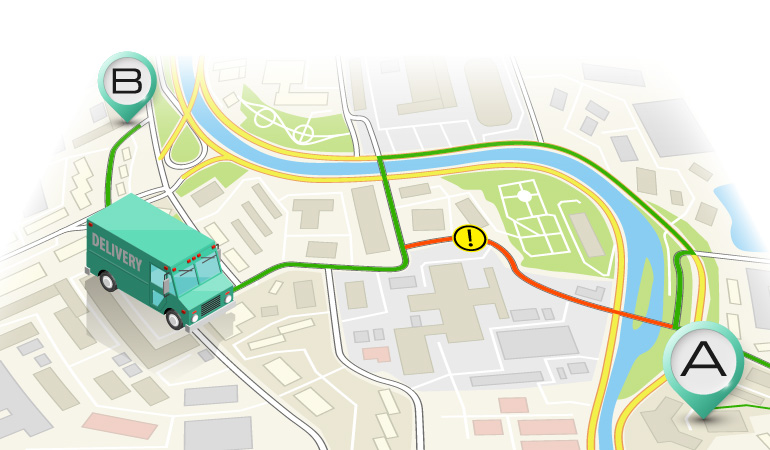
- build optimal routes for transportation and logistics companies
- calculate expenses and risks along a route, including toll costs
- optimize routes for faster and cheaper delivery by relying on up-to-date data
- consider all destinations along the route in case of delivery to multiple points