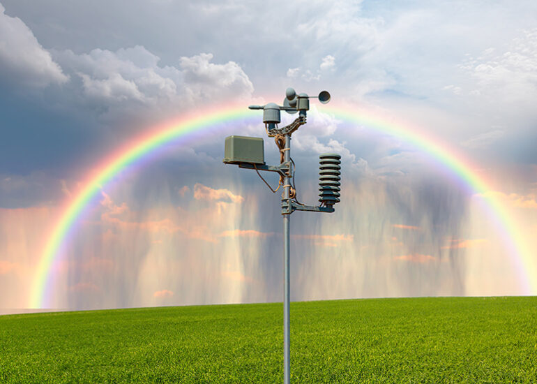
Maps have been critical assets for farmers throughout history. Land owners and farmers know their fields like the backs of their hands. With the addition of digital maps, agribusinesses gain a competitive advantage by knowing their land precisely based on geodata, not just experience.
Agricultural field mapping is an essential part of precision farming. Mapping technologies help farmers to find the exact locations of all crops on their farms and navigate across the area. They also can display location data on any crops. Apart from knowing the exact locations of crops, growers and agribusinesses can get a ton of valuable data on soil, product origins, moisture, and nutrient levels.
This article will answer the following questions for those working with agricultural holdings, small farmers, AgTech solutions providers, and product manufacturers and suppliers:
- How does precision mapping contribute to solving agribusiness challenges?
- What types of maps can agribusinesses use?
- How can you compile the most accurate maps?
- What are the real-life applications of mapping in agriculture and what benefits can they bring?
Let’s find out what precision mapping for agriculture can do for you.
How does precision mapping solve agribusiness challenges?
Agribusiness leaders need to accurately distinguish between different fields and manage them appropriately, improve efficiency and productivity, reduce maintenance and operational costs, and increase profitability by shifting from seasonal revenue to sustainable and predictable business growth. To achieve these goals, agribusinesses adopt various precision farming technologies.
Technologies adopted for precision farming
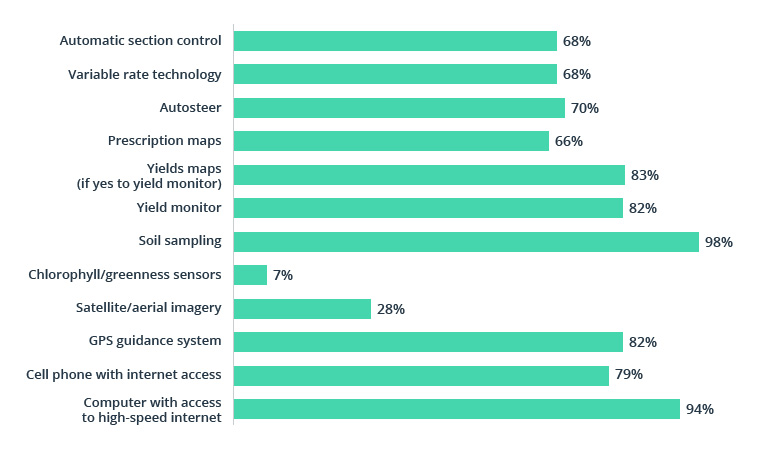
Source: Agricultural Economist
Precision mapping takes first place among these technologies. It combines telematics data from sensors with images from satellites and drones, matching them with maps to help agribusinesses achieve their goals within the location context. Proven results are expected to drive even higher adoption of mapping technologies in the future.
Use of different precision mapping techniques in 2018 and 2025 (predicted)
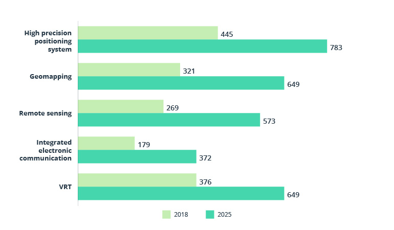
Source: Global Market Insights
Precision agriculture mapping works with various physical sensors, leveraging applications powered by the Internet of Things in agriculture industry. Sensors provide data on crops and soil moisture, irrigation, and yields. GPS and GIS (geographic information system) apps report the precise location of each sensor, while data platforms mix all input data into reusable maps for end users. Using GIS in agriculture helps agribusinesses optimize costs, provides deep insights, shows the exact distance to agricultural facilities, and helps agribusiness owners better plan the supply chain network for crop transportation.
What types of maps can agribusinesses use?
Ask older farmers about the land and they’ll tell you everything about it, evaluating soil with their naked eye. But what if we’re talking about thousands of square kilometers, taking into account hundreds of geo-referenced indicators? Agribusinesses should rely on different types of accurate maps to keep an eye on critical land characteristics on a large scale.
Soil zone maps
Farmers require soil zoning to see what’s going on at the soil surface to be aware of damaging irrigation and other soil problems that could hurt their long-term production strategy. Agriculture mapping service providers can compile soil zone maps by dividing fields into grids based on soil samples collected from individual grid blocks. The more samples you collect, the more grid blocks you’ll have for higher precision on soil zone maps.
GIS and GPS maps
GIS and GPS maps for farmers are a goldmine of reliable data on crop harvesting status, health, soil moisture, and the quality and quantity of resources. Agribusinesses can use GIS tools and web analytics platforms to forecast crop growth and subsequent agricultural production. Geoinformatics in agriculture strongly relies on custom GIS software solutions or commercial products by global providers, such as Google Earth Pro.
Satellite and drone imagery
Satellite and drone images work perfectly together. For example, farmers may rely on satellite data to prepare fields for heavy rain by predicting weather changes in advance, preventing the leaching of nutrients and seeds. They can also compare satellite images before and after rain to track drainage and find crops damaged by the weather. As for drones, images taken at a lower altitude are not obfuscated by clouds, as often occurs with satellite observations. Agribusinesses may use fleets of drones, flying them across fields to collect precise images of damaged crops, investigate crop conditions and homogeneity, or spray herbicides with a smart spraying technology in agriculture.
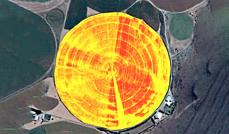
Crop yield maps
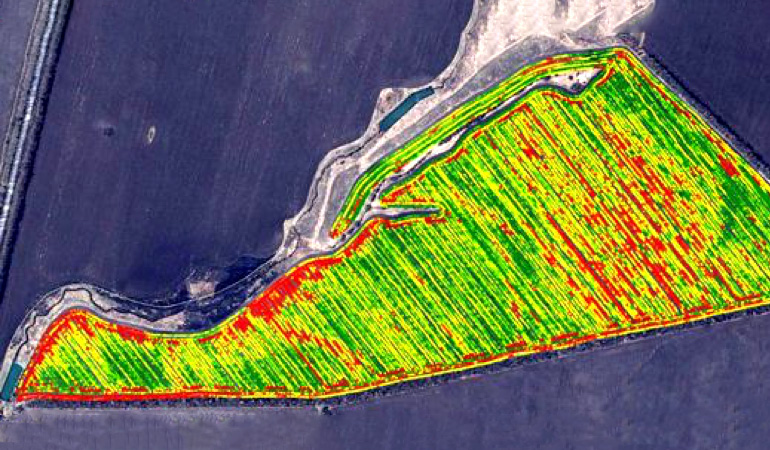
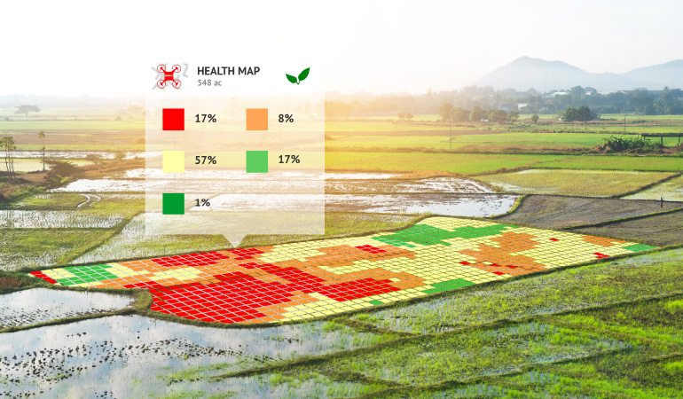
Combining satellite images and GIS data, agribusinesses can assess vegetation and crop yields. They can distinguish between soils and dense canopy to smartly manage crops in different seasons and identify yield-limiting factors. These types of precision agriculture maps serve as a visual tool to recognize correlations between crop yields and field condition indicators.
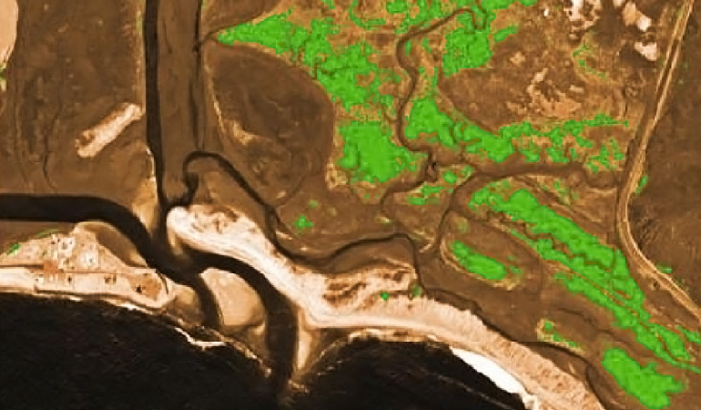
Green vegetation indices (NDVI maps)
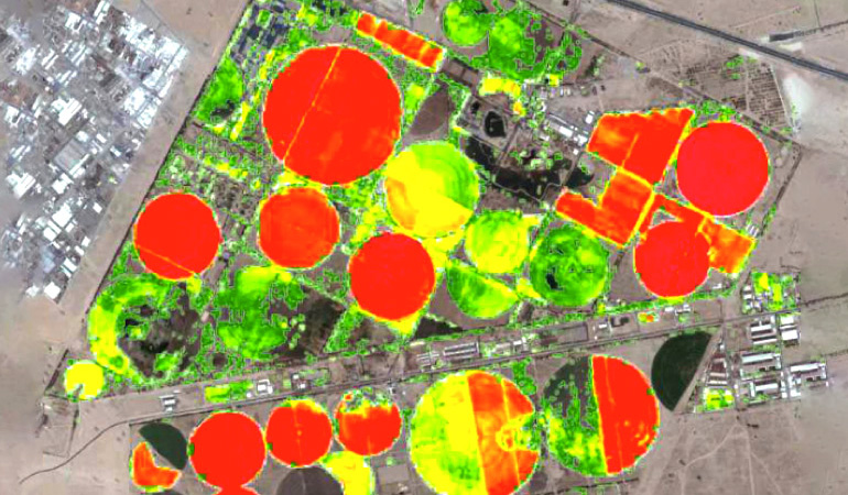
NDVI (Normalized Difference Vegetation Index) maps empower agribusinesses with the most accurate and comprehensive measurements of the amount of vegetation in their fields, define moisture levels, and qualify soil health. These maps can show environmental, social, physical, and other factors affecting crop growth. NDVI maps are critical for AgTech predictive software tools that determine where to take soil samples and what areas to choose to expand fields. These maps have proven to be the most significant factor in increasing agribusiness revenue and avoiding many potential problems with flooding and dry soils.
How can you compile the most accurate maps?
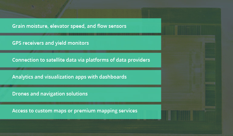
Farmers and agricultural companies should realize that they need more than just one map to monitor all critical factors for their business. In fact, they should combine a variety of technologies, tools, equipment, maps, and data. These include physical sensors installed on machinery and directly in the soil, GIS and GPS data, and images from satellites as well as from drones.
Typical tools and technologies for precision agriculture mapping
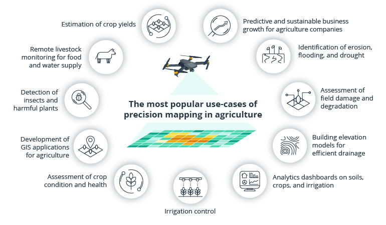
Real-life application of precision maps in agriculture and benefits they bring
By applying new precision agriculture technologies, farmers may increase the productivity of their land. Most of these technologies use different data collected on crops and fields. Precision mapping enriched with geo-referenced data tells farmers where and when they should sow seeds, how much water and nutrients to use, and what fields are ready for harvesting. This geodata can be used for various applications and data management platforms, analytics and prediction, guidance systems, and monitoring.
Conclusion
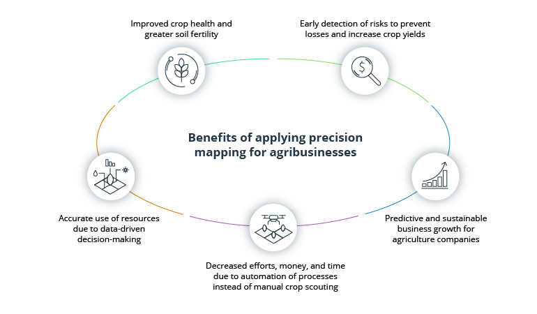
Precision mapping is fertilizing the tech revolution in agriculture. More private small farmers and big agroholdings are embarking on the digital transformation journey to maximize crop yields by tapping GIS and GPS mapping solutions provided by AgTech companies. Agribusinesses see a low-hanging fruit in winning more customers by applying precision technologies to their operations and services. At the end of the day, they may feast their eyes on sustainable business growth thanks to precise geodata received from agriculture maps.
Reach our location-based services experts with a deep focus on the agriculture industry to ask your questions regarding precision mapping technology and how to apply it to meet your unique business needs.